Lines Across the World
What the global convergence of sacred geometry, landscape alignment, and earth-grid thinking actually proves - and what it does not.
Traditions analyzed in this research
Site owner · Own
Score
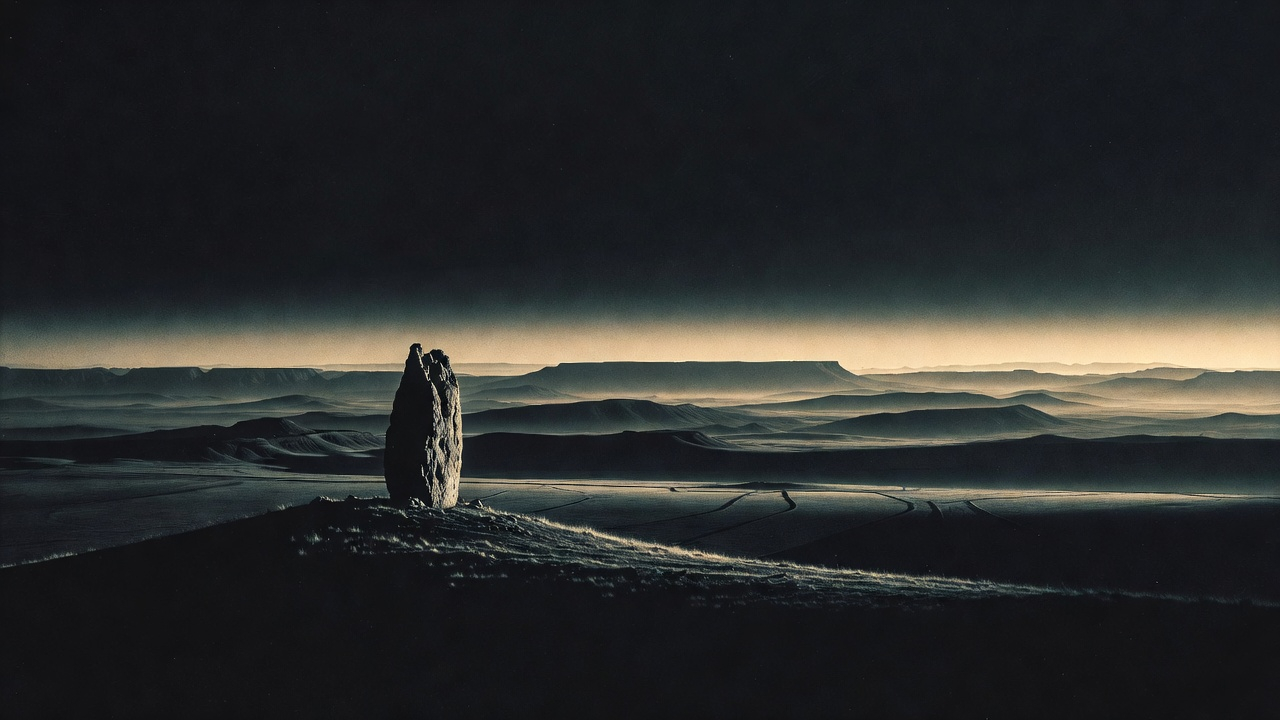
Did ancient civilizations around the world share a hidden system for mapping sacred meaning onto the landscape? Ley lines, dragon veins, songlines — the idea that these traditions point to one deeper truth has captivated people for decades. But where does the real evidence actually lead?
The popular ley line story is mostly a 20th-century invention. One writer in 1969 stitched together unrelated traditions into a single mystical narrative. That part falls apart fast. What doesn't fall apart is stranger. The Inca actually built a verified geometric network of sacred pathways spanning an empire. Aboriginal Australians encoded continent-sized libraries of knowledge into the land itself. These are not myths. They are documented, functional systems.
So the mystery isn't whether ancient people drew sacred lines on the earth. They did. The real question is why civilizations separated by oceans and millennia kept arriving at the same impulse — and whether "humans like patterns" truly explains what they built.
The modern ley line story has a surprisingly precise origin. In 1921, a Herefordshire businessman named Alfred Watkins noticed that ancient hillforts, churches, and standing stones in the English countryside seemed to fall along straight lines. His proposal was purely practical. He thought prehistoric Britons had used these alignments as walking tracks for navigation. It was a modest archaeological hypothesis, not a mystical one. For decades it stayed that way.
Then in 1969, John Michell published "The View Over Atlantis" and changed the entire conversation. Michell took Watkins' English trackways and wove them together with Chinese dragon veins from feng shui, Aboriginal songlines, ancient Egyptian temple alignments, and a generous measure of UFO speculation. The result was a single grand narrative: that all ancient civilizations had tapped into the same invisible network of earth energy. It was a literary act of synthesis, not a scientific discovery. But it landed at exactly the right cultural moment. Within a few years, the fused concept had become so widespread that most people forgot these traditions had ever been separate.
The trouble is that Michell's fusion obscured something real. Strip away the energy channels and the flying saucers, and you still find that civilizations on nearly every continent independently organized their sacred spaces using geometric principles. Some of these systems were not vague or symbolic. They were precise, functional, and enormous. The question is what to make of that pattern once you stop trying to force it into a single mystical framework.
The paper trail on this one leads in three very different directions at once. Each of the top findings dismantles one assumption and replaces it with something harder to explain away.
The Inca Built the Real Thing
While Western enthusiasts debated whether British stone circles accidentally line up, the Inca built exactly what ley line believers imagine. Forty-one pathways radiated from a single temple in Cusco, connecting over 300 sacred sites across the Andes. Spanish colonial records describe it. Modern archaeology confirms it. It served as calendar, administrative map, ritual schedule, and sacred geography — all at once.
Colonial-era Spanish administrators recorded the ceque system in enough detail that modern archaeologists have physically located and mapped the huacas it connects - this is not interpretation, it is field-verified ancient urban planning at imperial scale.
But the Inca weren't the only ones encoding knowledge into land.
A Continent-Sized External Hard Drive
Aboriginal Australian songlines are not spiritual metaphors. Cognitive scientists classify them as a real external memory technology — the landscape itself stores vast quantities of practical and cultural data, retrieved by singing while walking the route. A single songline can stretch thousands of kilometers across multiple language groups. The encoded information includes water sources, law, genealogies, and star maps. This system predates writing by tens of thousands of years.
Researchers have verified that specific verses of songlines correspond to specific landscape features that can be physically located and navigated to - the system is not metaphorical but operationally accurate.
That impulse to geometrize the sacred shows up in texts too.
The Universe Is a Dodecahedron - Plato Said So
Plato argued the universe itself was shaped like a dodecahedron — a twelve-faced geometric solid. He meant it literally. Meanwhile, the Hebrew Holy of Holies and the Christian New Jerusalem in Revelation are both described as perfect cubes. Whether this reflects cultural diffusion, shared Platonic influence, or independent convergence on the same geometric intuition remains genuinely unresolved.
The Holy of Holies in Solomon's Temple, the New Jerusalem in Revelation, and the Kaaba in Mecca are all described or understood as perfect cubes - three traditions, one geometric form, across three different theological frameworks.
These findings don't settle the question — they sharpen it into something harder to dismiss from either side. The same evidence that kills the mystical narrative also reveals a pattern that demands its own explanation.
The DebateTwo Cases. You Decide.
The debunking of mystical ley lines is airtight. But the real cross-cultural pattern underneath refuses to collapse into coincidence. That tension is where the actual argument lives.
Forget the mystical energy channels — the real case is stronger. Multiple civilizations, separated by oceans and millennia, independently built sophisticated geometric systems for organizing sacred space at landscape scale. The Inca ceque network and Aboriginal songlines are not folklore. They are verified, functional infrastructure that goes far beyond "humans like patterns."
The apparent convergence is a modern illusion with a known author. John Michell stitched together unrelated traditions in 1969 and called it a discovery. Statistically, British site alignments are exactly what random chance predicts. And after a century of searching, no one has ever measured a physical phenomenon along a proposed ley line — not once.
That disagreement is not a modern invention. Cultures across history have circled this identical question — whether the land itself holds a structure humans can learn to read — and arrived at answers that share almost nothing except the conviction that the answer is yes.
In Their Own WordsHow Different Cultures Tell It
The Demiurge, wishing to make the world as like as possible to the most beautiful and perfect of intelligible things, fashioned it as a single visible living creature, containing within itself all living creatures of the same natural order. And he gave it the shape which was fitting and akin to its nature. For the living creature that was to embrace all living creatures within itself, the fitting shape would be the figure that comprehends in itself all the figures there are - the sphere. And for the cosmos as a whole, he used the remaining fifth construction, the dodecahedron, and arranged it for the whole.
The cathedral is not built by human art alone. The proportions are given by God in the nature of things - in the ratios of musical harmony, in the geometry of the circle and the square, in the numbers of the Trinity and the Evangelists. When we build according to these proportions, we are not inventing beauty but discovering it, as it exists in the mind of God. The light that enters through the rose window is not merely physical light - it is the light of divine wisdom, made visible through the geometry of colored glass. The pointed arch reaches upward as the soul reaches upward toward God. The building is a prayer made of stone.
Weak convergence — limited cross-cultural agreement
20 traditions analyzed
The full picture on Lines Across the World is free.
6 findings, 9 cultural perspectives, full debate, timeline, sources with credibility ratings — everything, free with an account. No ads, no sponsors.